

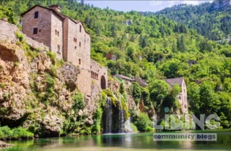
GR736 and the Tarn Gorge: An Analytical Exploration of France's New Long-Distance Trek
Table of contents
- Lead: the stakes of GR736 and what the route reveals about modern trekking
- Analytics through the GR736: designing a long-distance route that endures
- Contrasts along the gorge: wilderness, villages, and shifting footfall
- Cause-and-effect: ecology, economy, and governance in a growing trail system
- Expert reconstruction: actionable steps for sustainable trekking on GR736
- Conclusion: what durable trekking in the Tarn Gorge teaches us
GR736 is not merely a hike; it is a testbed for how long-distance routes reconcile wilderness, heritage, and community-driven tourism. The stakes are ecological integrity, economic vitality, and the cultural memory of villages along the Tarn Gorge. The hidden conflict lies in the tension between accessibility and fragility: the cooler microclimate in the gorge invites more visitors, but the ephemeral cliffside ecosystems and nesting birds require quiet seasons and careful management. This article maps the route's design, the biodiversity it aims to protect, and the governance necessary to sustain both the landscape and the people who rely on it. It offers a structured, expert lens on durable trekking.
Analytics through the GR736: designing a long-distance route that endures
The GR736 spans roughly 300 kilometers, threading from the Tarn’s source in the Cévennes uplands to the city of Albi. Its core appeal rests on a sequence of ecological and cultural gradients: a high, wind-blown upland transition to the river-carved limestone gorge, then a mosaic of medieval towns and abandoned hamlets clinging to cliff faces. The route’s architecture—bivouac-free by design yet richly serviced by staged lodgings—requires precise logistics, especially the baggage-transfer model that frees trekkers from heavy packs yet concentrates movement across a network of villages. These factors are not incidental: they are the levers that determine whether the route remains ecologically benign while delivering meaningful local value.
- Path design and topography: The route leans on balcon paths carved from rock, ensuring dramatic views without forcing steeper ascents that stress hikers and habitat alike.
- Logistics and support: A reliable baggage-transfer system, daily minivan arrivals, and village inns shape the cadence and predictability of the trek.
- Ecology as a framework: The gorge hosts more than 3,000 vultures and diverse riparian life, as well as beavers that subtly reshape wetlands and canopy structure. These ecological features guide route timing and wildlife-viewing norms.
- Cultural nodes as anchors: Castelbouc, Sainte-Enimie, Saint-Chély-du-Tarn, and Peyreleau are not just stops; they are benchmarks that calibrate the experience and anchor local economies.
- Biodiversity management: Management plans must balance bird-nesting seasons, amphibian migrations, and orchid peaks with visitor access windows to minimize disruption.
From an analytics perspective, the GR736 represents a deliberate attempt to fuse distance with discernible points of interest—landscapes that reward patient observation and villages that reward stewardship. The question is whether this architecture can scale without triggering ecological or social backlash. The data points to a cautious yes, but only if governance remains adaptive and transparent to stakeholders across communes and conservation agencies.
Practical design implications for durable trekking
- Seasonal windows: April–May and late September–early June offer favorable weather and reduced pressure on sensitive habitats.
- Carriage of luggage: The baggage-transfer model must be resilient to weather-induced delays and regional transport disruptions.
- Wildlife-friendly infrastructure: Balcon paths and viewing platforms should be designed to minimize disturbance during key breeding seasons.
- Village capacity planning: Lodgings, catering, and waste management must align with visitor flows and ecological carrying capacity.
- Monitoring and iteration: A lightweight, participatory monitoring program engages locals and researchers in adaptive management.
In short, GR736’s analytics point toward a pathway where long-distance trekking becomes a driver of both ecological respect and regional vitality—if designed with tight feedback loops and shared stewardship in mind.
Contrasts along the gorge: wilderness, villages, and shifting footfall
The Tarn Gorge presents a paradox: a landscape that feels primordial yet is increasingly seasoned by human traffic. The early-day wilderness—wind-swept heath, beech stands, and the limestone spires—offers a sensory baseline of isolation that invites a deeper observational practice. The villages, by contrast, provide cultural texture, culinary micro-moments, and livelihood pathways that rely on the presence of walkers. The intra-daily contrasts are pronounced: mornings in quiet uplands with distant vulture sorties; afternoons in the canyon where the river’s depth-wisps illuminate the canyon walls and the path slips into a human-scale corridor lined with old stone and new interventions.
- Wilderness vs. settlement: The route negotiates between untouched uplands and the human-dense sections around Castelbouc and Sainte-Enimie.
- Historical memory vs. modern logistics: Restorations of small villages sit alongside modern trail signage and booking platforms, a juxtaposition that can either enrich or erode the sense of place.
- Microclimate effects: The river plus gorge create cooler, moister microclimates that affect trail conditions and biodiversity cycles, influencing both flora and fauna activity.
- Tourist demand gradients: Peak season concentrates foot traffic along accessible segments, while remote stretches remain comparatively quiet but vulnerable to sudden surges when weather windows align.
These contrasts reveal a core tension: the more convenient and photogenic the route becomes, the greater the risk of homogenizing experiences and overloading fragile ecosystems. Leveraging these contrasts requires purposeful design decisions that preserve the drama of the landscape while distributing interest and impact across the entire corridor.
Contrasts in experience: a practical map for hikers
- Early-stage calm: Mont Lozère uplands reward with expansive views and sparse human presence, ideal for acclimatization and nature-watching.
- Mid-gorge drama: The 53-kilometer limestone gully offers spectacular geology and abundant raptor activity, demanding careful pacing and attention to safety on balcony routes.
- Village encounters: Castelbouc and Cirque des Baumes anchor the experience in human-scale, historically layered settings—sites where history and modern life intersect.
Each segment demands a different mode of observation: the uplands favor patient, long-view analysis of landscapes; the gorge requires rapid, precise interpretation of wildlife behavior and cliffline geology; villages demand cultural literacy to read architectural layers and local hospitality norms.
Cause-and-effect: ecology, economy, and governance in a growing trail system
Long-distance routes of GR736’s scale generate a cascade of ecological and socio-economic consequences. The most immediate effect is environmental housekeeping: better waste management, controlled visitation, and habitat monitoring. The secondary effect is economic uplift for small communities willing to adapt to trekking traffic. The most subtle effect is cultural transformation: a shift in local identity as villages transition from isolated bastions to nodes within a regional ecotourism network. None of these shifts is automatic; each requires governance that balances access with preservation, and ambition with humility before nature.
Ecology and biodiversity dynamics
- Beavers as ecosystem engineers: Beaver activity remodels riverbanks, creates wetlands, and influences plant communities—effects that ripple through fish and amphibian populations.
- Vulture populations: The presence of thousands of vultures implies stable scavenger dynamics and specific prey-base patterns; mismanagement can alter carcass availability and habitat use.
- Flora and orchid hotspots: The orchid-rich banks—monkey, bee, military, butterfly, pyramidal, fragrant—signal a sensitive pollination network that warrants seasonally mindful access.
Economically, local businesses benefit from guided walks, lodging, and dining, but the upside hinges on maintaining quality over quantity. When trails become overcrowded, erosion, waste, and habitat disturbance rise, undermining both biodiversity values and long-term tourist satisfaction. Governance must therefore couple visitor caps with adaptive management and transparent reporting to sustain both nature and livelihoods.
Economic and cultural ripples
- Cultural heritage preservation: Restored villages and historic itineraries can attract visitors who value authenticity, but preservation costs rise with visitor numbers.
- Local enterprise: Small inns, eateries, and guiding services flourish when demand aligns with capacity, producing a socio-economic multiplier effect across the Tarn region.
- Risk of over-tourism: Without deliberate distribution of traffic, peak-season stress can degrade trails, ruin early morning wildlife encounters, and erode the sense of wilderness.
Ultimately, the cause-and-effect logic of GR736 points to a governance model that emphasizes adaptive management, continuous monitoring, and co-created stewardship with local communities and conservation groups. The route’s success depends on translating ecological insight into practical rules that keep both landscapes and livelihoods resilient.
Expert reconstruction: actionable steps for sustainable trekking on GR736
Expert reconstruction translates insights into a concrete program. The aim is to preserve ecological integrity while enabling meaningful engagement with the Tarn Gorge’s landscapes and communities. The following recommendations draw on best practices from successful long-distance trails and the specific ecology and culture of the Tarn region.
- Structured seasonal access: Lock access to key segments within narrow windows to protect breeding birds, beaver habitats, and orchid peaks. Communicate these windows clearly to all operators and hikers.
- Dynamic capacity management: Implement real-time occupancy indicators for lodging and refuges, with contingency plans for weather-induced surges.
- Community-coordinated governance: Establish a GR736 council including village representatives, conservation groups, and regional tourism authorities to oversee route maintenance and interpretation.
- Education and interpretation: Deploy knowledgeable guides and self-guided materials that emphasize ecological literacy, caution around fragile sites, and respect for local culture.
- Monitoring and reporting: Create a lightweight ecological-monitoring protocol—bird counts, beaver activity, and trail erosion surveys—to inform adaptive management decisions.
- Infrastructure that respects geology: Build viewing platforms and balcony sections with minimal ground contact, using local stone and timber that age gracefully with the landscape.
- Economic inclusion: Direct revenue channels to remote hamlets via community-run guesthouses and locally trained guides, ensuring benefits are distributed widely along the route.
Beyond policy, the expert reconstruction hinges on a culture of continuous learning. The GR736 must remain a living system, capable of adjusting to changing weather patterns, wildlife behavior, and traveler expectations. The route should invite researchers, artists, and locals to contribute, ensuring that the Tarn Gorge is not just a destination but a collaborative, evolving landscape.
Synthesis and forward trajectory for GR736
GR736 embodies a rare convergence of dramatic geology, biodiversity, and human history. Its success as a long-distance route depends on deliberate balancing acts: distributing footfall without dulling awe, supporting villages without commodifying heritage, and evolving management practices without sacrificing the spontaneity that makes a trek memorable. If designed with adaptive governance, robust ecological safeguards, and inclusive local participation, GR736 can become a durable model for a new generation of ecotourism—one that respects the Tarn Gorge’s wild heart while enabling nearby communities to thrive.
This analysis presents a framework for evaluating and improving long-distance routes. The Tarn Gorge offers a testbed where ecological clarity and cultural depth intersect with the practicalities of modern travel. By treating GR736 as both a path and a policy instrument, planners, guides, and visitors can shape a future where the garden of Eden in the Tarn valley remains accessible, intact, and meaningful for decades to come.
Key takeaways for practitioners and enthusiasts
- Balance is core: Accessibility should be paired with strict ecological and cultural safeguards.
- Local empowerment matters: Revenue distribution to villages anchors sustainability and community buy-in.
- Evidence-informed tweaks: Continuous ecological monitoring and visitor feedback drive responsible adjustments to the route.
- Story-telling as stewardship: Interpreting the geology, flora, and history deepens appreciation and reduces reckless behavior.
In short, GR736 is more than a trek; it is a living test of how long-distance routes can harmonize wilderness, heritage, and livelihood in a rapidly changing world.

Notes: The discussion integrates observations from a five-day, self-guided segment of the GR736 through the Tarn Gorge, with reference to the route’s design and local ecosystems. The intent is to offer a rigorous, practical framework for sustainable trekking and conservation dialogue.
Practical capacity blueprint for durable trekking on GR736
To translate theory into action, this compact framework pins down segment-specific carrying capacity, seasonal windows, and a transparent governance cycle. The aim is to preserve ecological integrity while enabling meaningful village-benefit and high-quality trekkers' experiences.
Capacity matrix by segment
| Segment | Terrain/Features | Daily cap | Access window | Conservation note |
|---|---|---|---|---|
| Uplands | Mont Lozère to Castelbouc; open heath, wind exposure | 60 | Apr–May; Sep–Oct | Birder/watchers and beaver habitats sensitive |
| Mid-gorge balcony | limestone cliffs, vultures | 180 | May–Jun; Sep | Limit on balcony crossings to dawn/dusk |
| Village arc | Castelbouc to Peyreleau; historic cores | 120 | May–Oct | Local lodgings; waste management priority |
These provisional numbers offer a starting point for planning. Local data should refine targets, ensuring that visitor density aligns with habitat sensitivity and village capacity.
Be ready for dynamic conditions
Seasonal shifts require flexible access and monitoring.
Adaptive management cycle
- Monitor: collect wildlife counts, erosion metrics, and lodging occupancy weekly.
- Assess: compare against targets and identify bottlenecks or ecological stress.
- Adapt: adjust access windows, messaging, and lodging caps in consultation with communities.
- Communicate: publish transparent updates to guides, operators, and visitors.
What makes GR736 sustainable trekking?
GR736 sustainable trekking means balancing ecological protection, village vitality, and an engaging trek experience along a 300-kilometer corridor through the Tarn Gorge. It requires phased access, strict local governance, and revenue channels that fund conservation and community wellbeing. The aim is to protect habitats like beaver wetlands and raptor sites while offering authentic encounters with landscape, culture, and cuisine. In practice, sustainability hinges on adaptive rules, transparent reporting, and ongoing collaboration among communes, guides, and residents.
Rationale-wise, this approach translates ecological knowledge into concrete actions: habitat-aware scheduling, capacity controls, and interpretive programming that enriches visitor understanding and respect for local life. It also demands robust data collection and shared accountability to keep the route resilient over time.
How does the luggage-transfer system affect the trekking experience?
The luggage-transfer model reduces physical burden, enabling longer daily distances without heavy packs. This supports accessibility for a broader range of hikers and helps distribute footfall across the corridor. On the flip side, it creates dependence on reliable logistics and village-based support networks. Properly managed, the system improves safety, fosters local employment, and tightens coordination among lodging, transport, and conservation teams.
In practice, operators should schedule transfers within predictable windows, maintain contingency plans for weather, and communicate policy clearly to trekkers. A well-run system reinforces the long-distance route’s sustainability by freeing hikers to focus on scenery, wildlife, and culture rather than logistics.
When is GR736 best hiked to balance weather and wildlife?
Optimal periods are spring and late summer to early autumn, typically April–May and September–October, when temperatures are comfortable, water levels manageable, and wildlife activity—such as bird-nesting and beaver work—tends to be less disruptive to visitation. Shorter shoulder-season gaps can be added if staff capacity and ecological monitoring show it is feasible. Planning around dawn and dusk can further reduce wildlife disturbance on balcony segments.
Seasonal timing should be adjusted through an adaptive framework that uses occupancy data, bird counts, and habitat indicators to maintain ecological integrity without sacrificing the trekker experience.
What measures protect wildlife along the route?
Protective measures include restricted access during sensitive periods, clearly marked viewing paths, and quiet zones near nesting sites and wetlands. Guided interpretation emphasizes wildlife etiquette, while infrastructure such as elevated balconies minimizes ground contact and habitat trampling. Routine monitoring tracks beaver activity, raptor presence, and orchid phenology to adapt access windows in near real time.
These controls aim to maintain a high-quality wildlife experience for observers and photographers while ensuring that key species and habitats can thrive alongside trekking activity.
How can locals share in the benefits of GR736 trekking?
Local benefit comes from a mix of guesthouses, guided services, and seasonal employment that aligns with carrying capacity. Transparent revenue-sharing with villages and conservation groups funds habitat restoration, waste management, and interpretation programs. Community-led enterprises ensure that earnings reinforce cultural preservation, language retention, and culinary traditions, creating a resilient local economy even in variable tourism conditions.
Ultimately, the model relies on ongoing collaboration, performance reporting, and inclusive governance that invites residents to shape the route’s future as a living, evolving system.





Add a comment
To comment, you need to register and authorize
Comments